Chiricahua Wilderness Area Adventures
Chiricahua Wilderness Area is a rugged, mountainous terrain known for its stunning rock formations and diverse ecosystems, offering exceptional opportunities for hiking and wildlife viewing.
About Chiricahua Wilderness Area
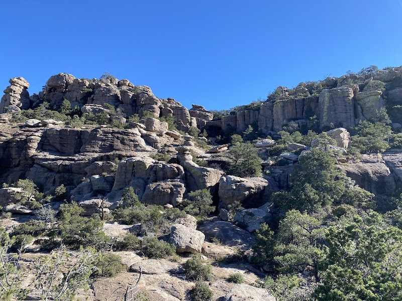
Chiricahua Wilderness Area, located in southeastern Arizona within the Coronado National Forest, covers an expansive 87,700 acres of unique geological and biological diversity. This area is characterized by its craggy mountain ranges, dramatic rhyolite formations known as 'hoodoos', and lush flora fueled by its varying elevations ranging from 5,160 to 9,759 feet. The wilderness supports a myriad of ecosystems, from pine forests to high desert grasslands, making it a hotspot for biodiversity and wildlife, including black bears, coatimundis, and a variety of bird species. Historically, the region was home to the Chiricahua Apache and later served as the backdrop for European settlers and the Butterfield Overland Mail route. Today, visitors immerse themselves in the natural beauty of its 50 miles of trails, exploring notable landmarks such as Chiricahua Peak and Echo Canyon. The remote and rugged landscape offers a peaceful retreat for backpacking, photography, and nature study, drawing outdoor enthusiasts seeking solitude and adventure.
Highlights
Chiricahua Peak – the highest point in the wilderness providing incredible vistas
Unique hoodoo rock formations scattered throughout the region
Diverse wildlife spotting opportunities including rare bird species
Echo Canyon – famous for its panoramic views and rock formations
Notable Natural Features
Hoodoo Rock Formations
These towering, thin spires of rock offer a dramatic landscape feature that attracts photographers and geologists alike.
Chiricahua Peak
The tallest point in the wilderness area, offering expansive views of the surrounding region.
Echo Canyon
Known for its spectacular rock formations, this canyon is a highlight for hikers and offers breathtaking views.